


Sensorem, a leading technology integrator and remote sensing company, employs the latest advancements in drone technology and remote operations to deliver precision data collection and insightful analysis. Utilising state-of-the-art drones equipped with high-resolution cameras, LiDAR sensors, and autonomous flight capabilities, we capture detailed and accurate spatial data from diverse environments. Our drone-in-a-box solutions enable continuous, remote operations, enhancing safety and efficiency by minimising the need for human intervention in hazardous or hard-to-reach areas.
By leveraging advanced data processing software, we transform raw data into actionable insights. Our comprehensive approach ensures precise planning, design, and maintenance, optimizing operational strategies and enhancing decision-making. Sensorem’s commitment to utilizing cutting-edge technology and remote operations ensures the delivery of high-quality, reliable data and solutions for a wide range of industries. Our processed data is complemented by thorough analysis and comprehensive reporting, providing clients with a complete picture for informed decision-making.
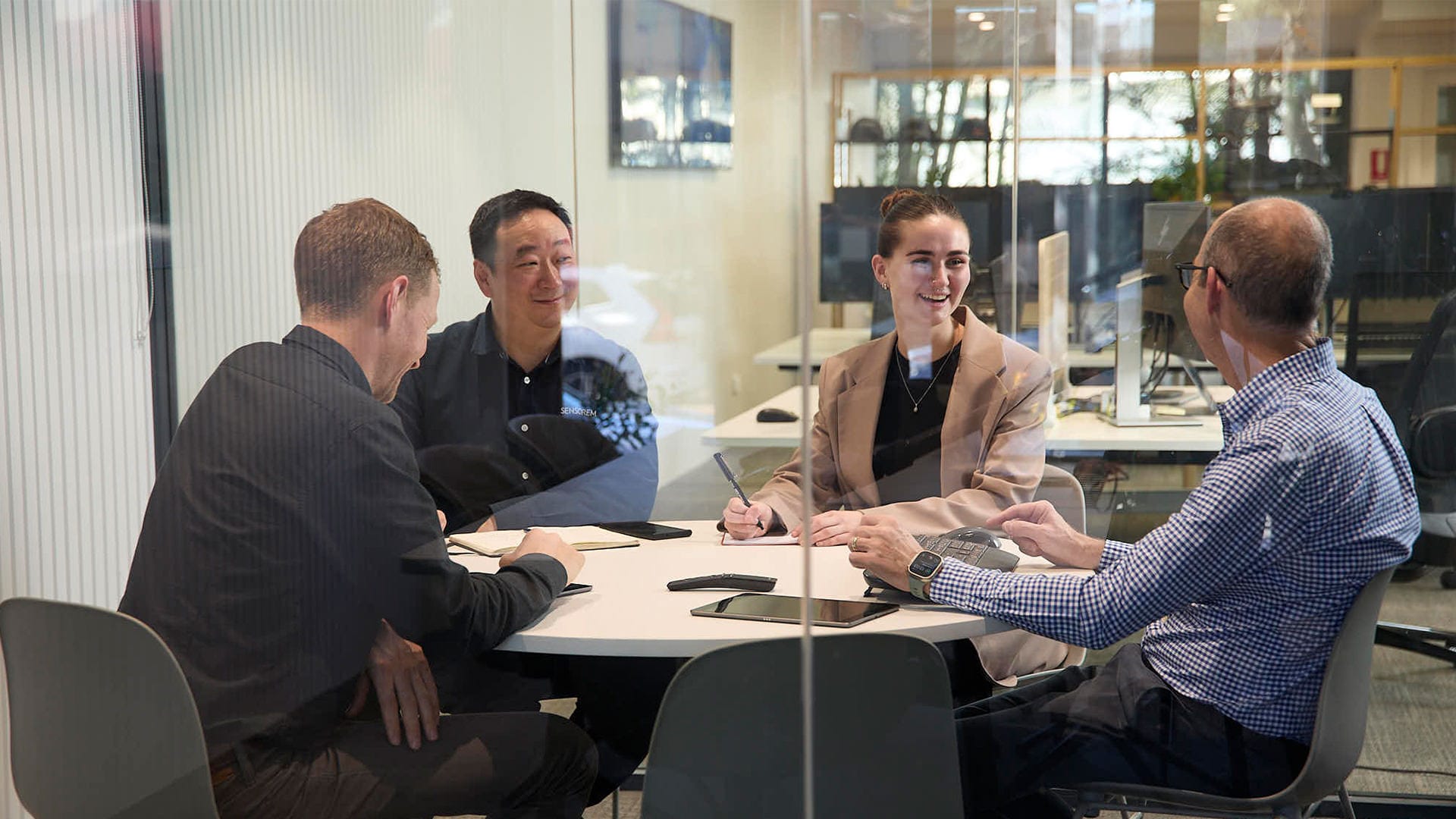
Our expertise extends beyond data collection and processing to include comprehensive project management and consultation services. We work closely with clients to understand their specific needs and tailor our solutions to meet their unique requirements. This client-focused approach ensures that our data-driven insights are not only accurate but also highly relevant and actionable, empowering clients to make informed decisions that drive efficiency and success in their operations.
Transforming Data into Actionable Insight
Collection
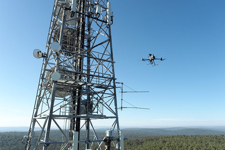
Sensorem collects data through meticulous planning and the use of the latest technologies to ensure reliable and safe capture. Each mission begins with a comprehensive assessment of the site and project requirements, allowing us to develop a tailored flight plan that maximises coverage and data quality. Our drones are equipped with cutting-edge sensors, including high-resolution cameras and LiDAR, enabling precise and accurate data collection even in challenging environments.
Safety is paramount in our operations. We employ autonomous flight capabilities to minimise human intervention, reducing risk in hazardous areas. Our advanced control systems and real-time monitoring ensure that every flight adheres to strict safety protocols, guaranteeing reliable data capture without compromising operator or asset safety. This meticulous approach to data collection ensures that our clients receive the highest quality data for their projects.
Processing
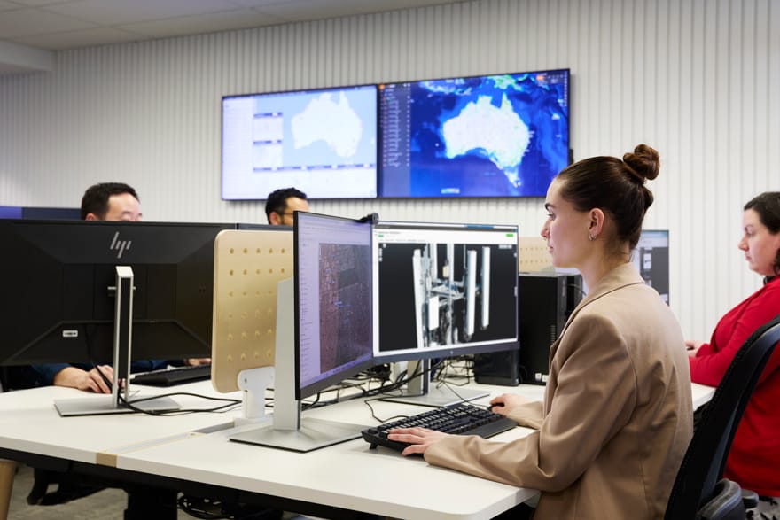
At Sensorem, we process data using the latest software and powerful computer systems to transform raw data into actionable insights. Our advanced data processing tools integrate only the highest quality data collected in the field, to create detailed deliverables. This ensures accurate analysis and visualisation, allowing us to deliver precise and comprehensive data outputs for various applications.
Our in-house processing computer systems handle large datasets efficiently, enabling swift processing and analysis. This robust infrastructure supports the application of complex algorithms and analytical techniques, enhancing the quality and depth of the insights generated. By leveraging state-of-the-art technology, we ensure that our clients receive reliable, high-quality data that informs their decision-making and optimises their operational strategies.
Delivery
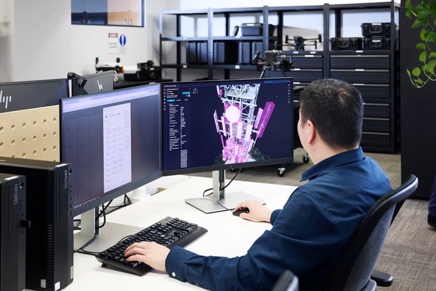
At Sensorem, we deliver the final processed data derived from advanced drone and remote sensing technologies through comprehensive interactive reports and cloud-based visualisation platforms. These reports provide detailed analyses, 3D models, and visual insights, ensuring that the information is accessible and easy to understand. Our interactive reports allow clients to explore data dynamically, offering a clear and in-depth view of their assets and environments.
Our cloud-based visualisation platforms further enhance data accessibility and collaboration. Clients can securely access and interact with their data from anywhere, facilitating real-time decision-making and project management. These platforms support various data formats and offer tools for measuring, annotating, and sharing insights, ensuring that our clients can leverage the full potential of the data to optimise their operations and strategic planning.
How does a digital twin work?
A Digital Twin of an asset is a dynamic, virtual representation that replicates the physical asset in real-time, integrating data from various sources such as reality capture, CAD models, and IoT sensors. Reality capture involves using high-resolution imagery and LiDAR scans to create detailed 3D models of the asset, while CAD models provide precise design and structural information.
This comprehensive digital model allows for continuous monitoring and analysis, simulating real-world conditions and behaviours. By incorporating real-time data and advanced analytics, digital twins enable predictive maintenance, performance optimisation, and enhanced decision-making, providing a powerful tool for managing and improving the lifecycle of the asset.