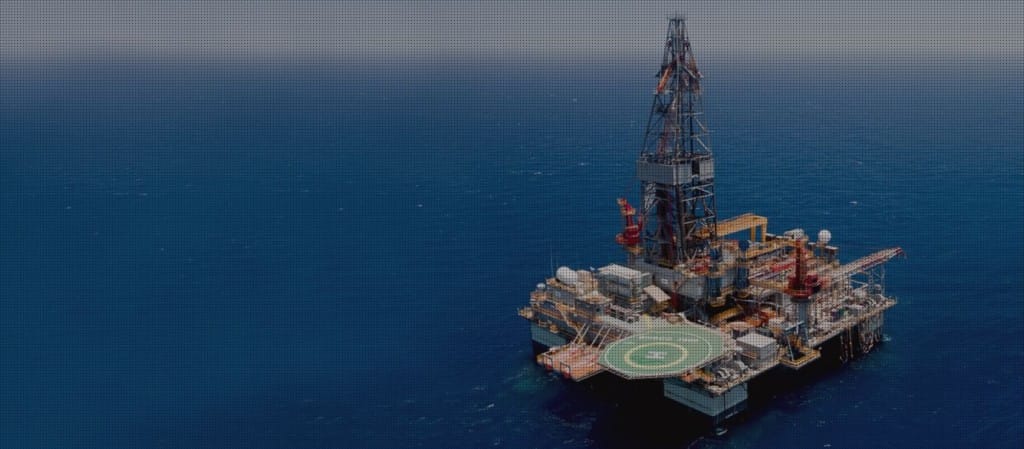


Drone technology is reshaping the oil and gas industry.
How autonomous drones are supporting the oil & gas sector
Autonomous drones deliver safer, faster and far more detailed inspection workflows across upstream, midstream and downstream operations. Drone inspections support asset integrity teams by reducing the need for scaffolding, shutdowns and working at height, while capturing high-resolution visual, thermal and LiDAR data to assist engineering, maintenance and HSE decision-making.
Key services
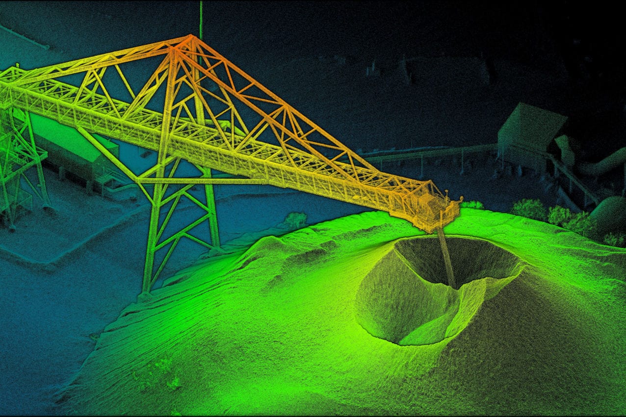
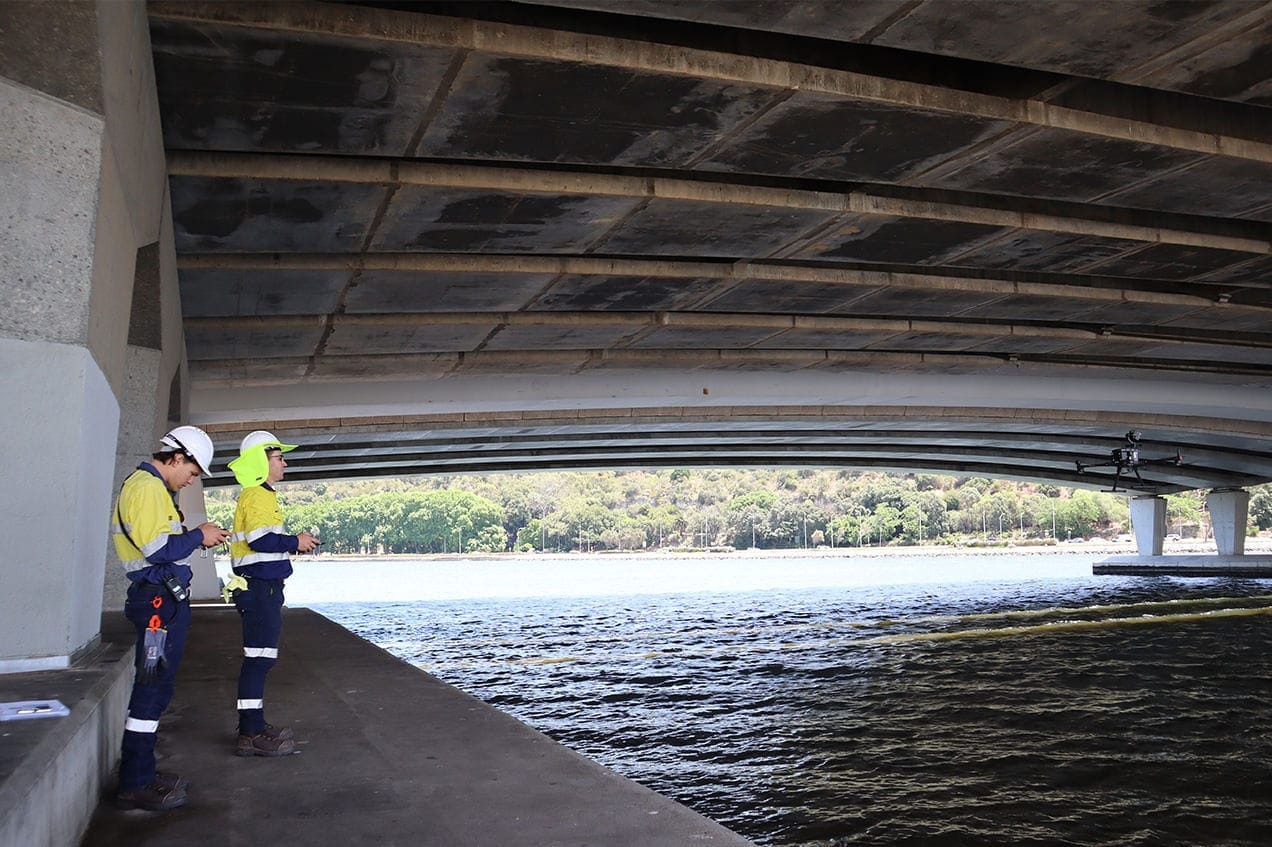
Drone & Terrestrial Laser Scanning
Drone inspections support a wide range of oil and gas applications, allowing operators to assess critical assets more safely and efficiently. Sensorem combines high-resolution imagery, thermal sensors to deliver accurate visual data, 3D models and engineering-grade site documentation.
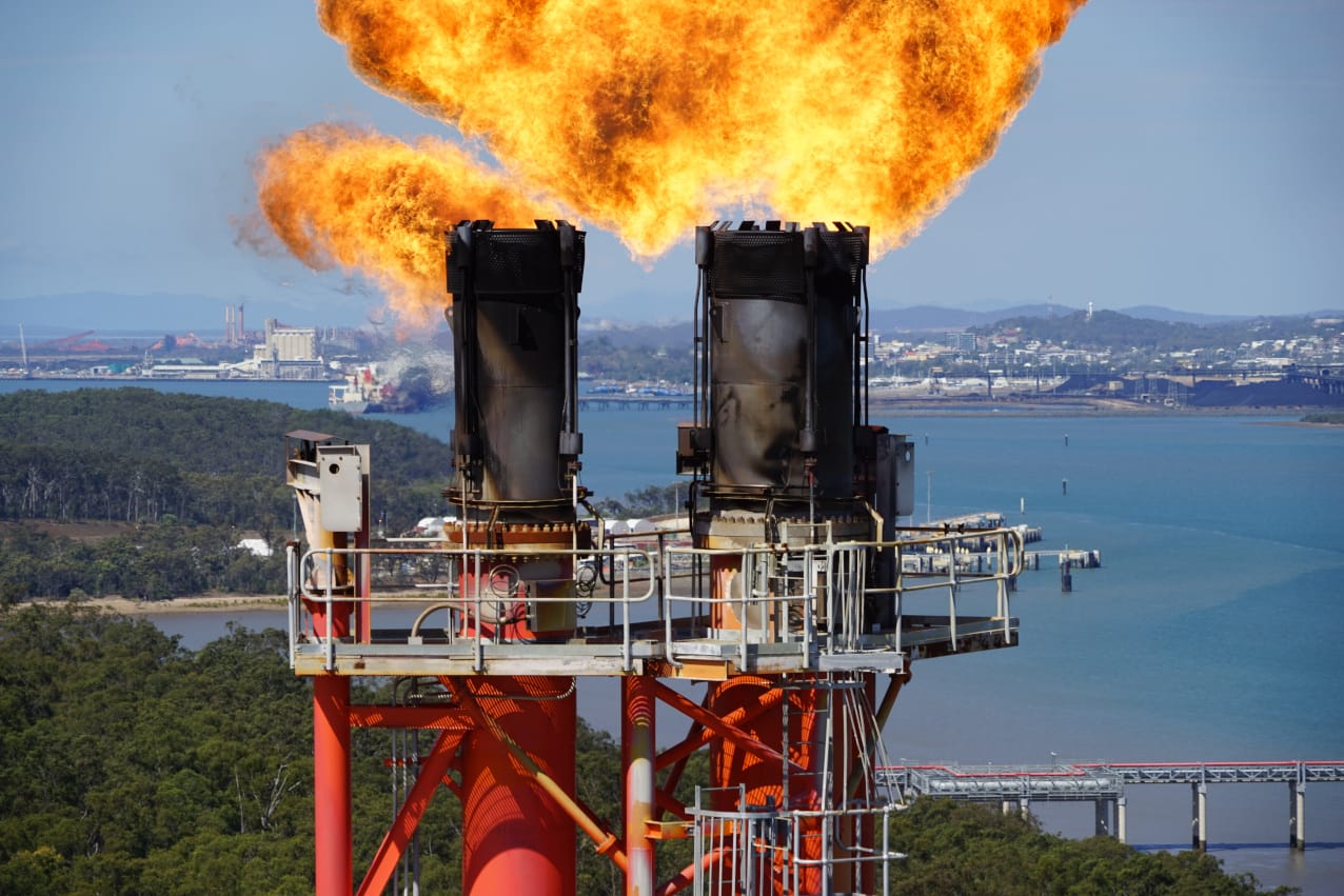
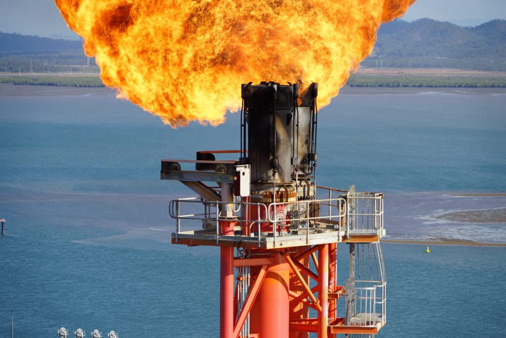
Flare Stack Inspections
Drones can inspect flare stacks and elevated structures without placing personnel at risk or requiring extensive shutdowns. High-resolution and thermal imaging identify corrosion, deformation, hot spots, structural defects and general wear. This approach offers safer access, reduced downtime and more frequent integrity assessments.
They can also use visual and thermal imaging to detect leaks and ensure regulatory compliance.
Digital Twins
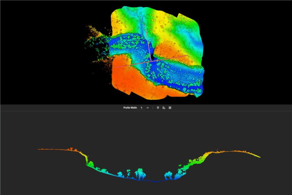
Sensorem creates detailed 3D digital twins of oil and gas facilities using photogrammetry and LiDAR. These models provide a precise record of structural layout, clearances and asset condition- supporting engineering reviews, maintenance planning, commissioning, and decommissioning programs. Digital twins also reduce site visits by enabling teams to assess assets remotely.
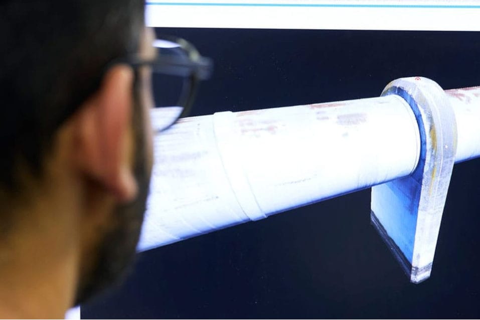
Pipe inspections
Our drone inspections support the assessment of pipelines, pipe racks and associated infrastructure. High-resolution imagery, LiDAR and LPS detection help identify corrosion, mechanical damage, encroachment, vegetation impact and structural concerns. Drones also support pipeline corridor right-of-way monitoring, aiding early detection of risks and compliance with operational requirements.
Gas Leak detection
Drone mapping plays a key role in environmental monitoring for oil and gas operators. High-resolution visual and terrain data help track erosion, vegetation changes, coastal impacts, flood behaviour and landform movement. Thermal imaging supports heat-source detection and can assist in identifying potential leak-related anomalies.
These insights help operators maintain compliance, detect environmental risks early and support long-term environmental planning.
Exploration & Planning
Drones offer efficient capture of survey-grade terrain data for exploration, planning and pre-construction activities. Using high-accuracy photogrammetry and LiDAR, Sensorem produces Digital Elevation Models (DEM), Digital Surface Models (DSM), orthomosaics, contour models and full 3D site documentation to support engineering and design teams.
Drone-in-a-box
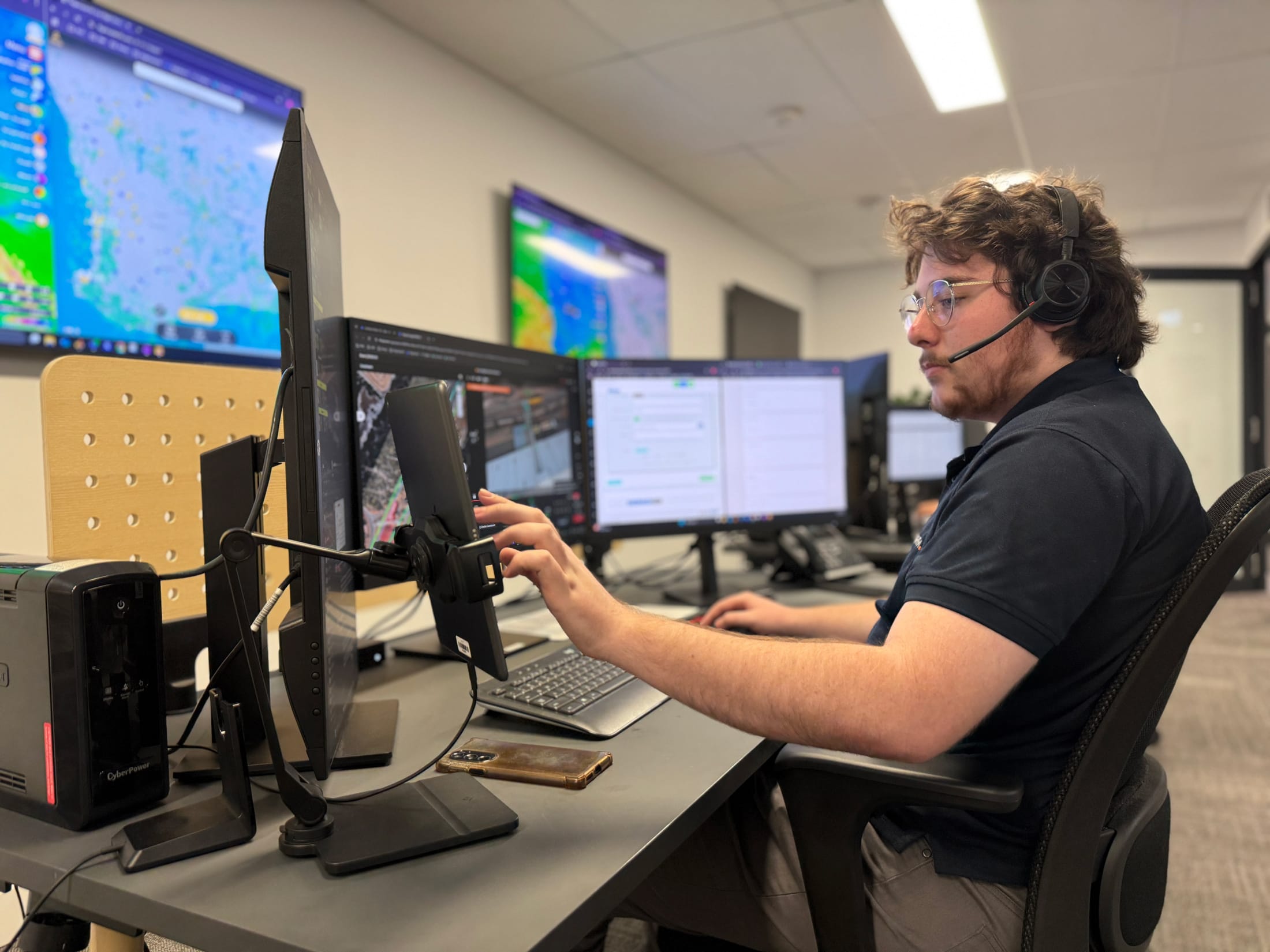
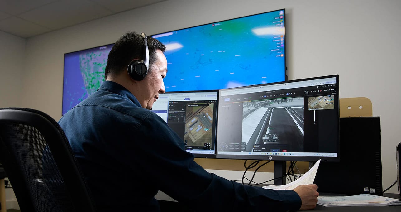
Sensorem deploys Drone-in-a-Box (DiaB) systems for sites that require ongoing monitoring, routine inspections or rapid response during critical events. These autonomous units support construction progress, pipeline and corridor oversight, site security and general asset inspections, providing continuous situational awareness without requiring personnel on site.
NDT (Non-destructive Testing)
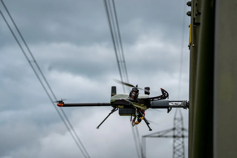
Sensorem offers drone-based NDT inspections, using advanced inspection drones such as the Voliro platform equipped with ultrasonic, thickness-gauge, and specialist payloads. This enables precise structural integrity assessments of assets such as flare stacks, storage tanks, piping systems and offshore infrastructure – without the need for scaffolding, rope access or shutdowns. Drone-based NDT significantly reduces inspection time and cost, improves safety by removing personnel from hazardous areas, and delivers high-fidelity data for maintenance teams, integrity engineers and asset managers
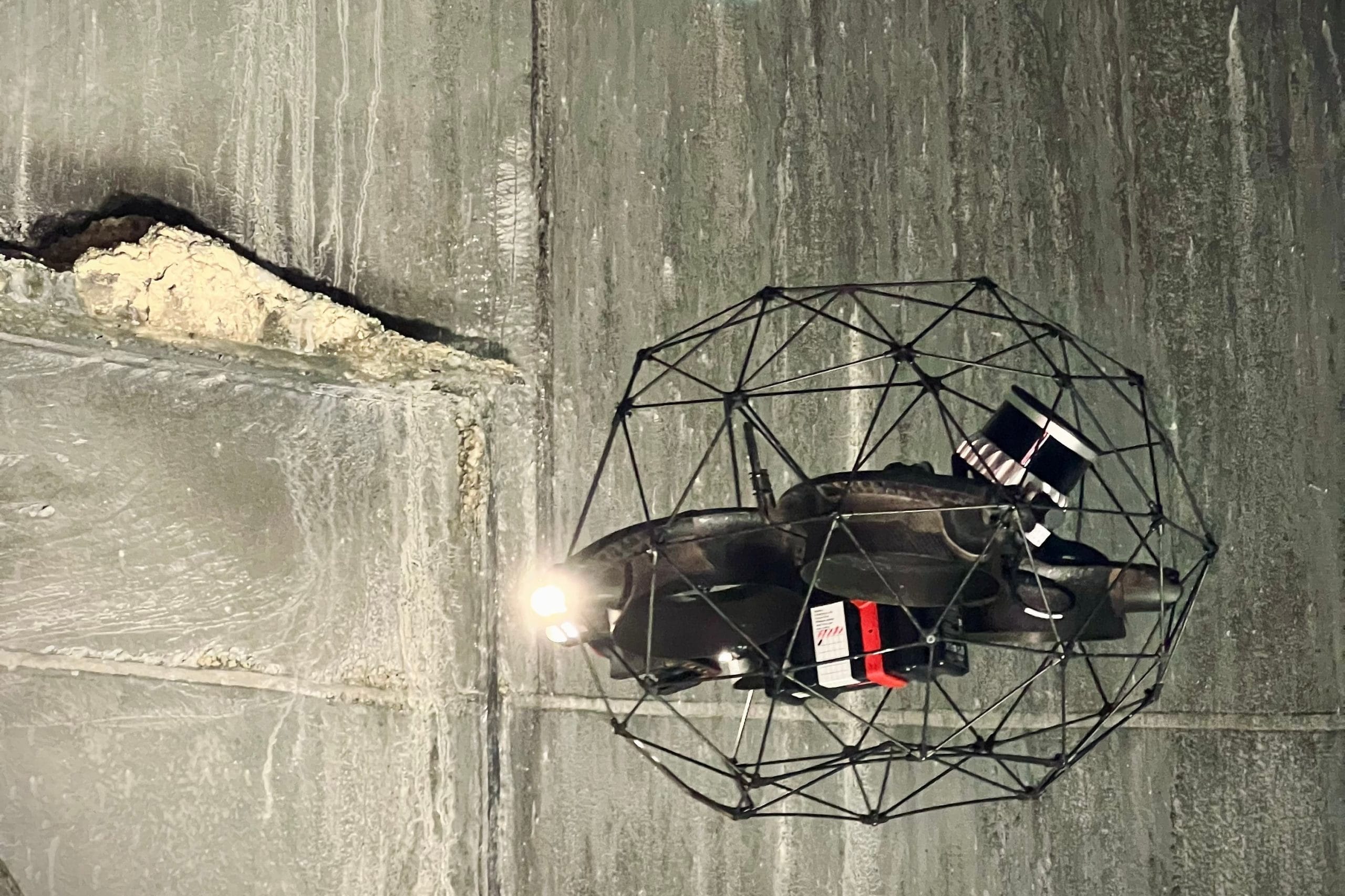
Confined space & cage drone inspections
For enclosed or hard-to-access environments, Sensorem uses cage-protected drones (Elios 3) to safely inspect tanks, internal pipe runs, culverts and confined spaces. This reduces the need for human entry, enhances safety and provides high-resolution visual records of internal surfaces for maintenance and integrity reviews.
Environmental monitoring and gas leak protection
Drones play a critical role in environmental oversight and gas-hazard monitoring across oil and gas facilities. By integrating advanced sensors such as Sniffer4D V2, UAVs can assess site conditions, detect anomalies and support rapid decision-making – all without exposing personnel to risk.
High-accuracy environmental mapping
Using high-resolution cameras, LiDAR and photogrammetry, drones generate detailed 2D and 3D environmental datasets, including Digital Elevation Models (DEM) and terrain models. These datasets help operators monitor:
- vegetation changes around pipelines and well pads
- shoreline and coastal erosion near marine assets
- flood-plain behaviour around critical infrastructure
- ground deformation, subsidence or stability issues
This supports long-term environmental planning, compliance reporting and early identification of areas requiring attention.
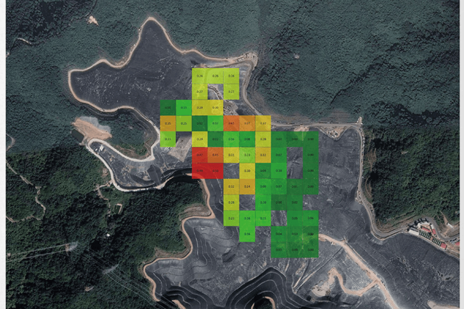
Multi-gas detection & emissions mapping
With payloads such as Sniffer4D V2, drones can monitor multiple gases simultaneously — including CH₄ (methane), VOCs, H₂S, SO₂, NO₂, CO₂ and odour units — and produce real-time 2D or 3D concentration maps. These capabilities assist with:
- pipeline and wellhead leak detection
- tank-farm and processing-unit emissions checks
- fugitive-emissions monitoring
- air-quality assessments around facilities
- boundary-zone or community-impact monitoring
HAZMAT, emergency response & rapid deployment
In emergency scenarios – such as suspected gas leaks, fires, oil spills, or chemical releases – drones equipped with multi-gas sensors can be deployed ahead of ground teams to:
- identify the type and spread of toxic gases
- establish safe entry perimeters
- Provide accurate 2D & 3D map
- assess wind and dispersion behaviour
- provide real-time situational awareness & Live feed to incident commanders
Oil spill & hydrocarbon detection
Multispectral and thermal sensors can differentiate oil from water, allowing operators to detect surface spills or sheen rapidly. This supports early intervention, environmental protection and compliance with spill-response requirements
Why Sensorem?
Sensorem is a leading Australian provider of drone inspection, LiDAR mapping and digital twin solutions for the oil and gas industry. For more than a decade, we’ve supported major operators including Woodside Energy with high-quality visual, thermal and survey-grade data across upstream, midstream and downstream assets.
Our operations team is fully compliant with the HSE, induction and access requirements of major oil and gas facilities, ensuring safe, repeatable data capture on live plants, pipelines, tank farms and offshore platforms.
We also provide Drone-in-a-Box (DiAB) systems for clients who require autonomous monitoring, scheduled inspections, security patrols or rapid deployment during emergency events. DiaB gives operators continuous site visibility while reducing exposure to hazardous environments.
For organisations looking to build or improve their internal drone program, Sensorem can also supply a Chief Remote Pilot to help manage or develop your RPAS department, ensuring regulatory compliance, pilot competency, SOP development and safe operational standards.
Backed by CASA-certified procedures and extensive field experience, Sensorem delivers the accurate, engineering-ready datasets required to support asset integrity, maintenance planning and environmental compliance across the full lifecycle of oil and gas infrastructure.
7000+
Asset inspections completed
724
3D digital twins constructed
50+
Drone flights per day across Australia
14
Full time remote drone pilots
7,378
Kilometres flown
140
Terabytes of data processed and analysed