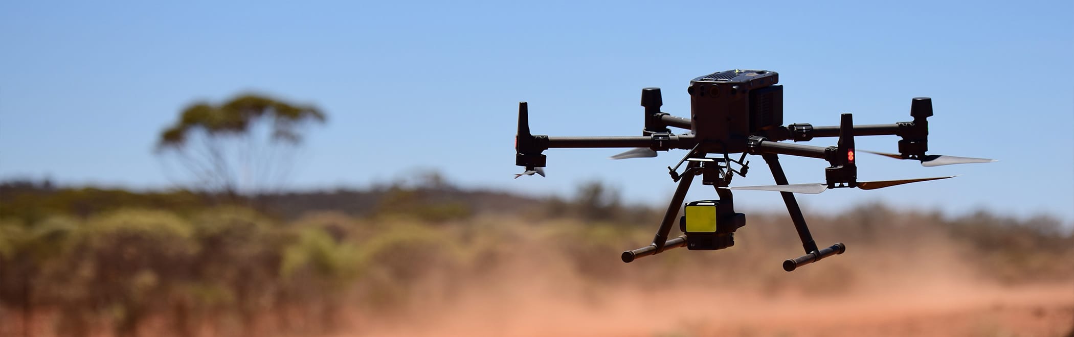


Sensorem uses advanced drones with high-resolution cameras and LiDAR sensors for precise survey and mapping. These drones capture detailed topographic data and 3D models, enhancing accuracy and efficiency. Autonomous flights ensure comprehensive coverage and safety, while advanced data processing transforms raw data into valuable insights for optimized planning and decision-making.
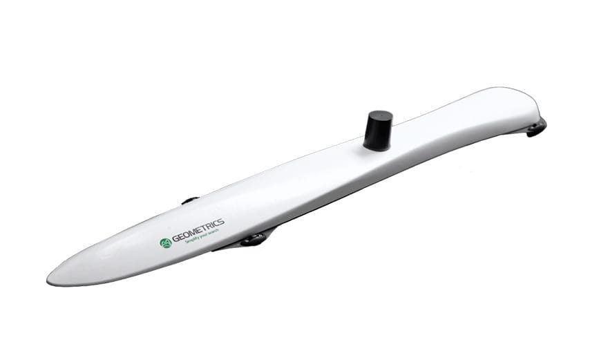
MagArrow II Magnetometer
The MagArrow II is an advanced drone-mounted magnetometer system designed for high-precision geophysical surveys. It features cutting-edge magnetic sensors capable of detecting subtle variations in the Earth’s magnetic field, making it ideal for mineral exploration. The system is lightweight and easily integrated with Sensorem’s drone platforms, allowing for efficient and extensive magnetometer surveys. Its high-resolution data capture and real-time processing capabilities enable detailed subsurface mapping and anomaly detection. The MagArrow II enhances survey efficiency and accuracy, providing valuable insights for geologists, environmental scientists, and engineers.
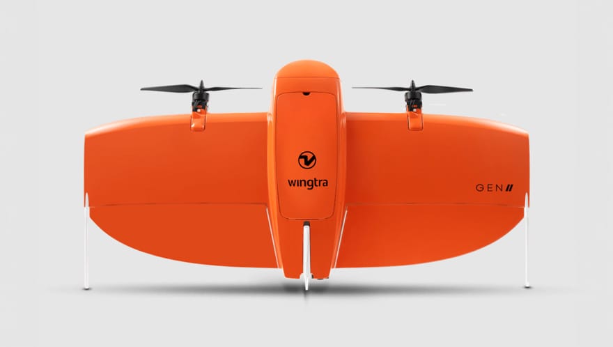
Wingtra Gen II
The Wingtra Gen II drone is a state-of-the-art VTOL (Vertical Take-Off and Landing) aircraft designed for high-precision surveying and mapping applications. Combining the versatility of a multirotor with the efficiency of a fixed-wing, it ensures reliable performance in diverse environments. Equipped with advanced sensors and high-resolution cameras, the Wingtra Gen II delivers accurate and detailed geospatial data, making it ideal for large-scale projects. Its user-friendly interface and automated flight planning simplify operations, while its durable construction ensures resilience against harsh conditions. The Wingtra Gen II is a powerful tool for professionals in construction, agriculture, mining, and environmental monitoring, providing efficient and precise aerial data collection.
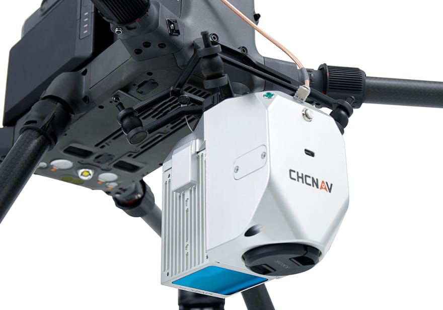
CHCNAV AA450 LiDAR
The CHCNAV AA450 LiDAR is an advanced aerial mapping system designed for high-precision geospatial data collection. Integrating a powerful LiDAR sensor with high-resolution imaging capabilities, the AA450 delivers accurate and detailed 3D maps and models, making it ideal for surveying, construction, forestry, and environmental monitoring. The AA450’s user-friendly interface and automated workflows streamline data acquisition and processing, enhancing efficiency and productivity.
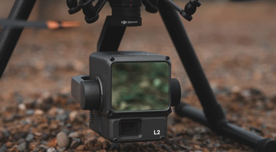
DJI L2 LiDAR
The DJI L2 LiDAR is a cutting-edge aerial mapping and surveying system designed for high-precision data collection. Featuring an advanced LiDAR sensor, the L2 captures detailed and accurate 3D point clouds, making it ideal for applications in topographic mapping, forestry, urban planning, and infrastructure inspection. Its integration with DJI’s drone platforms ensures seamless operation and real-time data transmission, enhancing efficiency and productivity. The L2 LiDAR system offers robust performance in various environments, with features like obstacle avoidance and automated flight planning for safe and reliable missions.