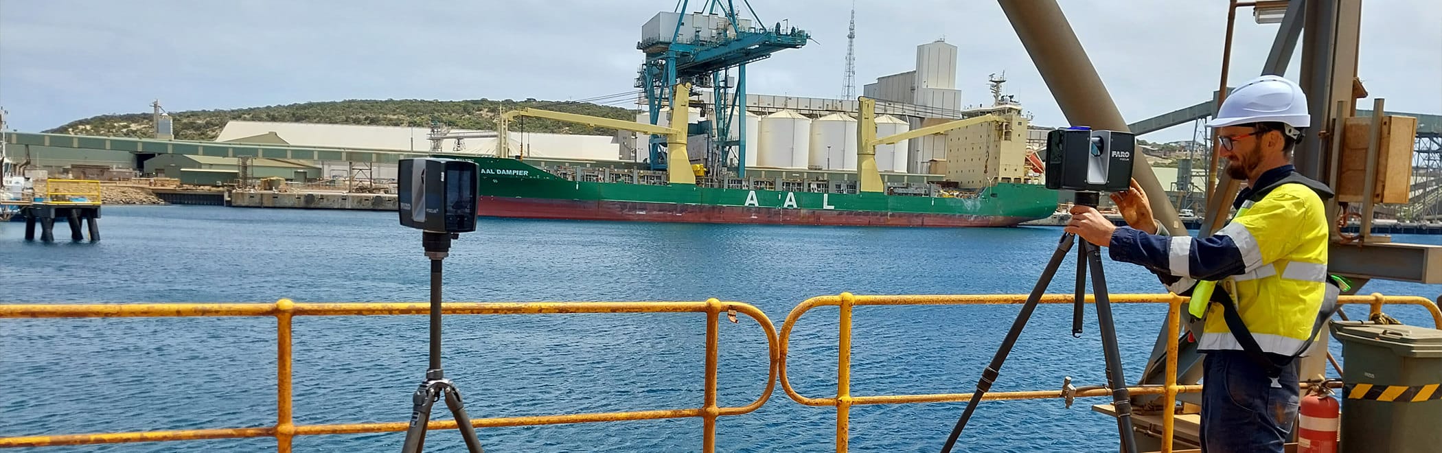


Sensorem’s GIS team takes full advantage of our in-house cutting edge laser scanning and LiDAR technology to create detailed 3D models, CAD drawings, and BIM (Building Information Modelling). This high-resolution data aids in accurate visualisation, design, and simulation of structures and environments. It integrates seamlessly into CAD for precise engineering tasks and into BIM for comprehensive digital representations, enhancing planning, construction, and facility management.
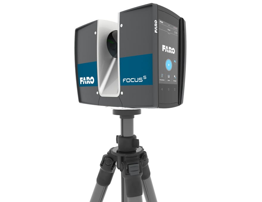
FARO S70
The FARO Premium S70 is a high-precision 3D laser scanner designed for capturing detailed and accurate spatial data in a variety of applications, including construction, architecture, and industrial manufacturing. With its ability to scan at ranges up to 70 meters, the S70 provides exceptional accuracy and resolution, enabling the creation of precise 3D models and digital twins. The scanner is equipped with advanced features such as HDR imaging, which enhances data quality in diverse lighting conditions, and a compact, lightweight design for easy portability and use in tight spaces. The FARO Premium S70’s user-friendly interface and seamless integration with software platforms streamline data processing and analysis, making it an indispensable tool for professionals seeking reliable and comprehensive spatial documentation and analysis.
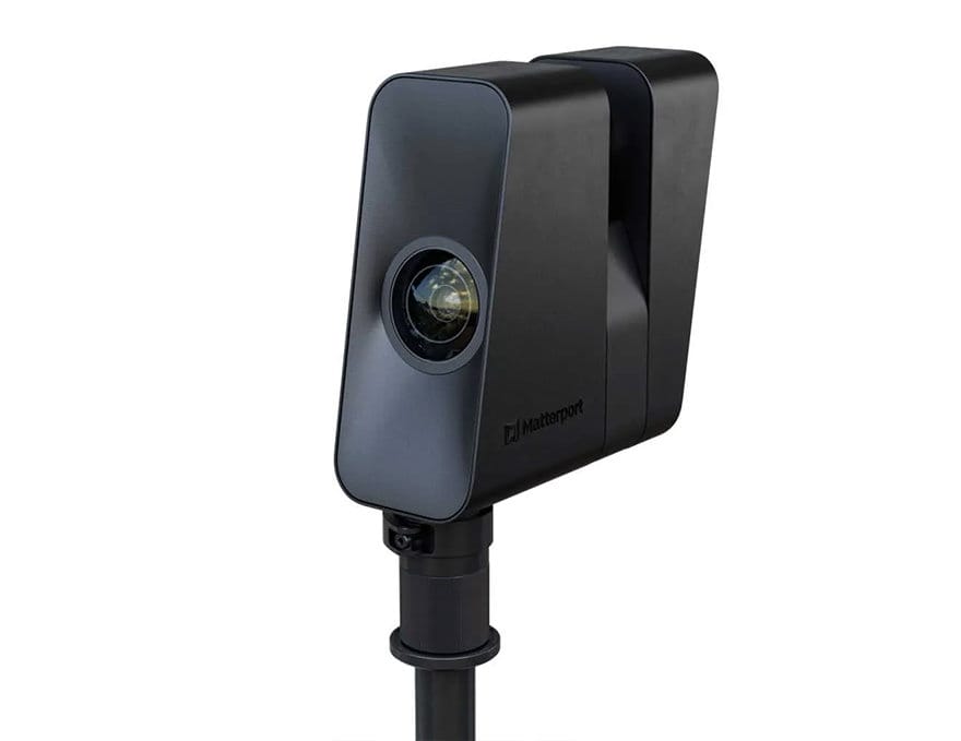
Matterport Pro 3
The Matterport Pro 3 is a cutting-edge 3D camera designed for creating immersive and highly detailed digital twins of physical spaces. Ideal for real estate, construction, architecture, and retail, the Pro 3 captures high-resolution 3D scans and 4K HDR images, delivering precise and realistic virtual tours. With its advanced LiDAR sensor, it ensures accurate measurements and seamless integration with Matterport’s cloud platform for easy processing and sharing. The Pro 3’s robust and portable design allows for quick setup and scanning in various environments, making it an essential tool for professionals aiming to enhance visualisation, documentation, and collaboration through state-of-the-art 3D technology.
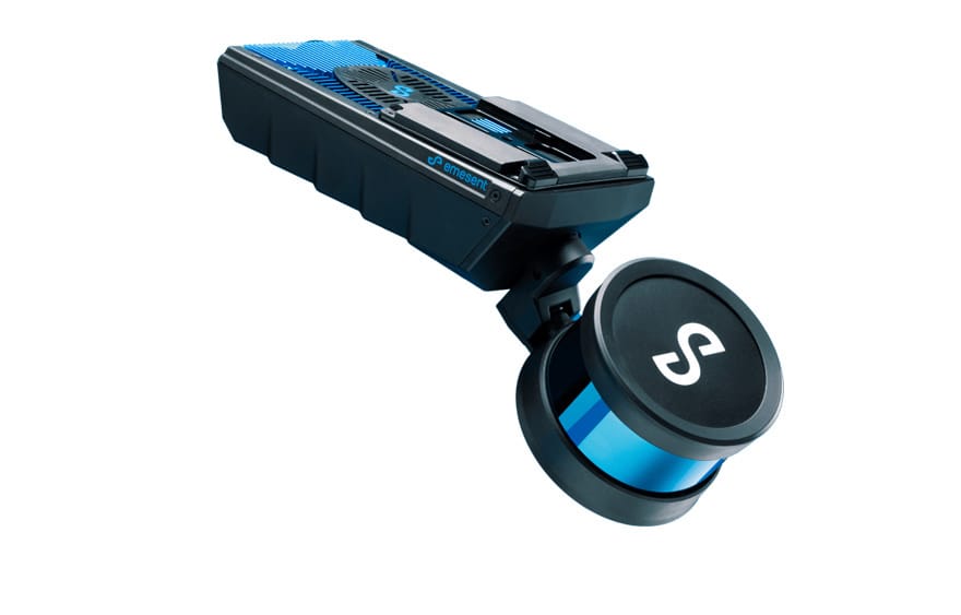
Emesent Hovermap
The Emesent Hovermap is an advanced mobile scanning solution that combines autonomous flight capabilities with high-precision LiDAR mapping for challenging environments. Designed to be mounted on drones or used as a handheld device, Hovermap enables the capture of detailed 3D data in GPS-denied areas such as underground mines, dense forests, and complex industrial sites. Its robust LiDAR sensor and SLAM (Simultaneous Localisation and Mapping) technology provide accurate real-time mapping, even in low-light or obstructed conditions. Hovermap’s versatility and ease of use make it an invaluable tool for professionals in mining, construction, forestry, and infrastructure inspection, enhancing safety, efficiency, and data quality by enabling comprehensive and precise spatial documentation in hard-to-reach locations.