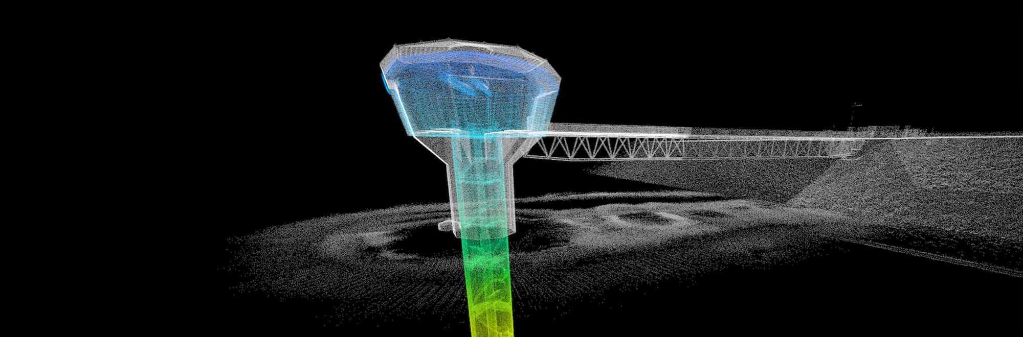


Sensorem utilises advanced data processing software to transform raw data from drone and sensor technology into meaningful insights. By integrating high-resolution imagery, LiDAR scans, and other sensor data, the software enables accurate analysis and visualisation of structures and terrains. This processed data is converted into detailed 3D models, CAD drawings, and BIM representations, facilitating precise planning, design, and maintenance. The robust analytical tools within the software also help identify potential issues, optimise operational strategies, and enhance decision-making, ensuring efficient and effective management of assets across various industries.
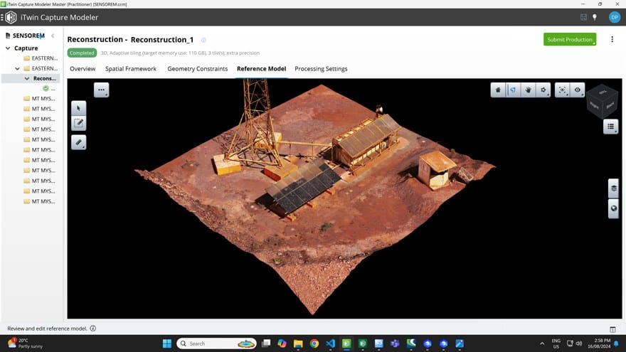
Bentley iTwin Capture Modeler
Bentley iTwin Capture Modeler is advanced software designed for the efficient creation of highly accurate 3D models from reality data. By leveraging photogrammetry and LiDAR point clouds, it transforms aerial and ground-based imagery into detailed digital twins of physical environments. This software supports a wide range of applications, including infrastructure inspection, construction monitoring, and urban planning. Its intuitive interface and powerful processing capabilities enable users to seamlessly integrate and manage vast amounts of reality data, producing precise and actionable 3D models. With robust tools for data analysis, measurement, and visualisation, Bentley iTwin Capture Modeler enhances project efficiency and decision-making, making it an invaluable asset for professionals in engineering, construction, and geospatial industries.
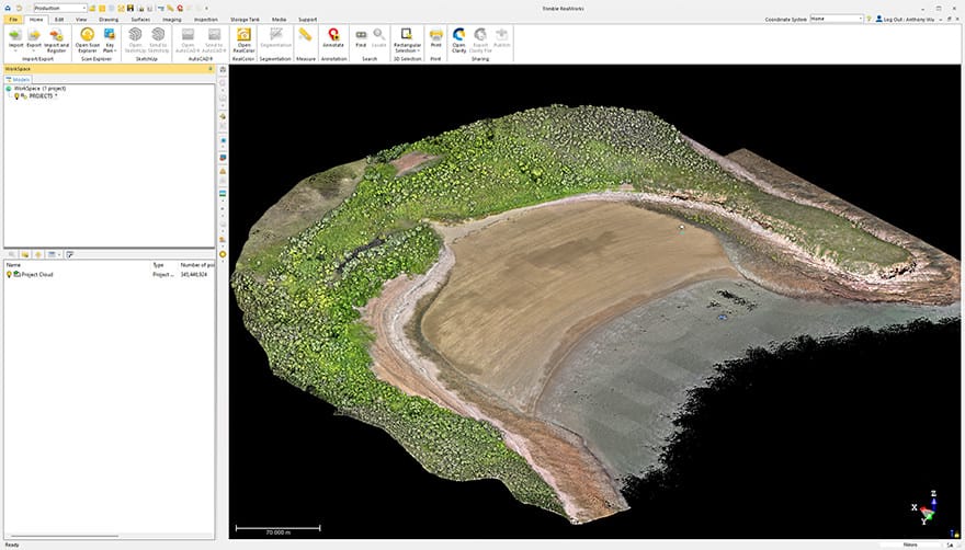
Trimble RealWorks
Trimble RealWorks is a comprehensive software solution designed for processing, analysing, and visualising 3D laser scanning data. Ideal for surveyors, engineers, and geospatial professionals, it provides powerful tools for transforming raw point cloud data into actionable information. With features like automated registration, point cloud editing, and advanced modelling capabilities, RealWorks streamlines the workflow from data capture to deliverable creation. Users can generate accurate 3D models, perform detailed inspections, and conduct precise measurements, enhancing project accuracy and efficiency. The software’s intuitive interface and robust functionality make it an essential tool for managing complex data sets and producing high-quality, reliable outputs for various applications, including construction, civil engineering, and infrastructure maintenance.

Trimble Business Center
Trimble Business Center is a versatile software platform designed to streamline the processing and management of geospatial data for surveying and construction professionals. It integrates data from various sources, including GNSS, total stations, drones, and 3D laser scanners, providing a unified environment for data analysis, visualisation, and project management. With robust features for data editing, CAD drafting, surface modelling, and volume calculations, Trimble Business Center enhances accuracy and efficiency throughout the project lifecycle. Its intuitive interface and powerful tools enable users to create precise deliverables, such as topographic maps, as-built surveys, and construction plans. By facilitating seamless data integration and workflow automation, Trimble Business Center helps Sensorem improve productivity, reduce errors, and ensure the successful completion of complex geospatial projects.
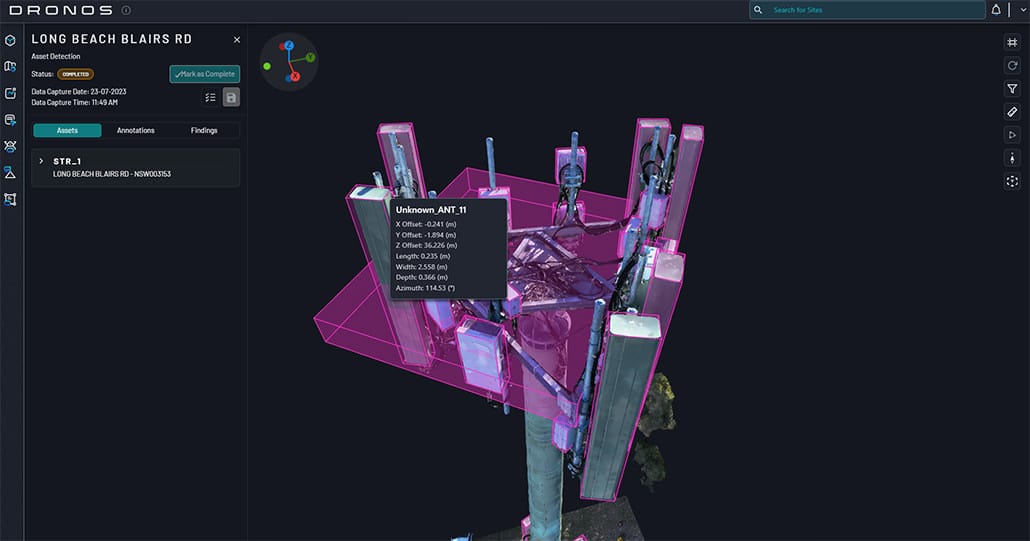
DRONOS Telco
Aerodyne DRONOS Telco is an innovative software solution designed to optimise the management and maintenance of telecommunications infrastructure using drone technology. It leverages advanced data analytics and AI to process high-resolution imagery and sensor data captured by drones, providing detailed insights into the condition of telecom assets such as towers and antennas.
The software enables automated inspection, fault detection, and predictive maintenance, significantly reducing the need for manual inspections and enhancing operational efficiency. With its user-friendly interface, DRONOS Telco allows telecom operators to easily plan missions, analyse data, and generate comprehensive reports. This results in improved accuracy, safety, and cost-effectiveness in maintaining and managing telecom infrastructure, ensuring reliable service and network performance.
This software, developed by Sensorem’s parent company, has been imbedded into Amplitel (Telstra company) asset management systems, and currently hosts 4500 telco sites from across Australia.

Pix4D
Pix4D is a leading software suite designed for advanced photogrammetry and drone mapping applications, transforming aerial imagery into precise, actionable data. Ideal for industries such as surveying, construction, agriculture, and real estate, Pix4D offers powerful tools for creating detailed 2D maps and 3D models. Its user-friendly interface and automated workflows enable users to easily process images captured by drones and generate high-resolution orthomosaics, digital surface models, and point clouds. The software’s robust analytical capabilities allow for accurate measurements, volumetric calculations, and terrain analysis, enhancing project planning and decision-making. With seamless integration into various GIS and CAD platforms, Pix4D streamlines data processing and improves efficiency, making it an indispensable tool for Sensorem, as our team seek for reliable and comprehensive geospatial insights.