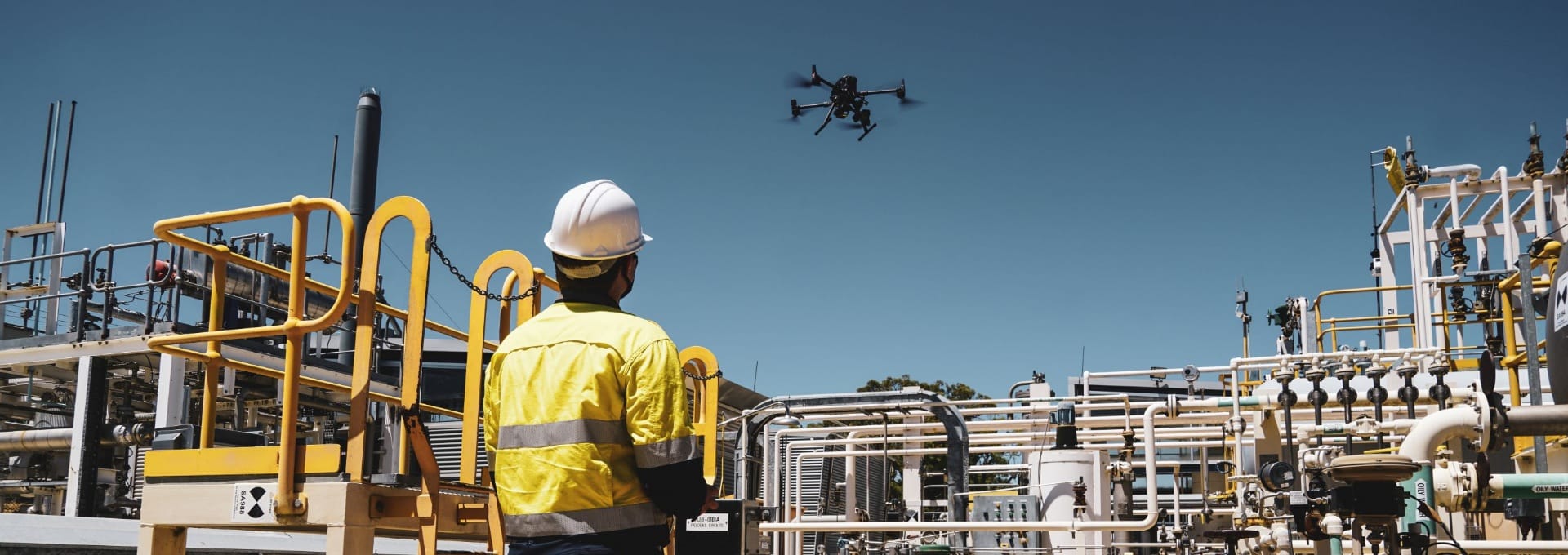


Sensorem utilises advanced drones with high-resolution cameras and LiDAR sensors for asset inspection, capturing detailed visual and spatial data. Autonomous flight capabilities ensure continuous monitoring, enhancing safety and accuracy.
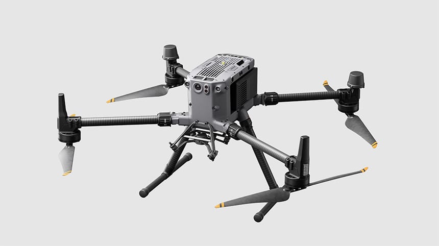
DJI M350 RTK
The DJI M350 RTK is a versatile, high-precision drone designed for professional use in mapping, surveying, and inspection. Equipped with Real-Time Kinematic (RTK) technology, it delivers centimetre-level accuracy for precise data collection. The M350 RTK features a robust build, enabling it to operate in various challenging environments. It supports multiple payload configurations, including advanced cameras and sensors, making it adaptable for diverse applications. Enhanced flight safety features, such as obstacle avoidance and redundant systems, ensure reliable and secure operations. With extended flight times and advanced connectivity options, the DJI M350 RTK is an ideal solution for complex aerial missions requiring high accuracy and reliability.
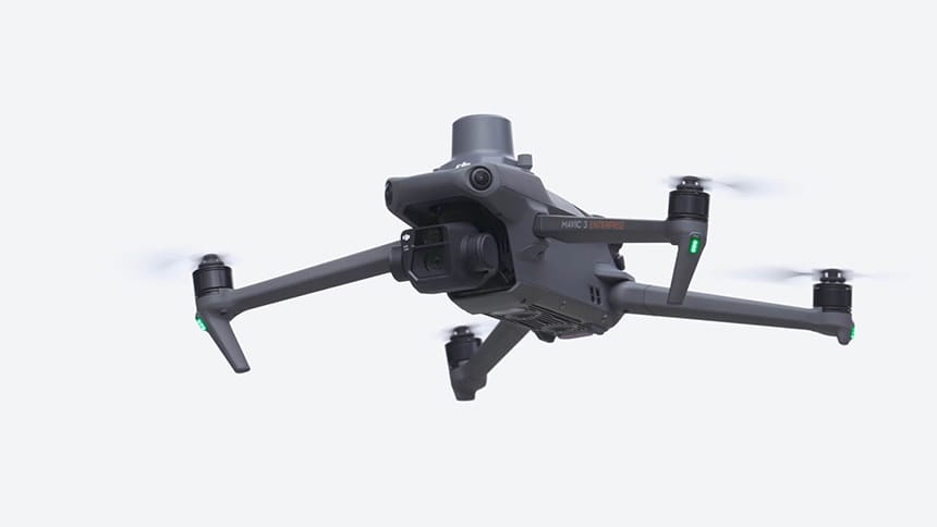
DJI M3E RTK
The DJI Mavic 3 Enterprise RTK is a compact and powerful drone designed for professional applications requiring high-precision data. Integrated with Real-Time Kinematic (RTK) technology, it provides centimetre-level accuracy, making it ideal for surveying, mapping, and inspection tasks. The Mavic 3 Enterprise RTK features an advanced imaging system with a high-resolution camera and thermal sensor, allowing for detailed and versatile data capture. Its compact design ensures portability and ease of deployment, while extended flight times and enhanced obstacle avoidance capabilities ensure safe and efficient operations. With robust connectivity and intuitive control software, the DJI Mavic 3 Enterprise RTK offers a reliable and efficient solution for various industrial and commercial aerial missions.
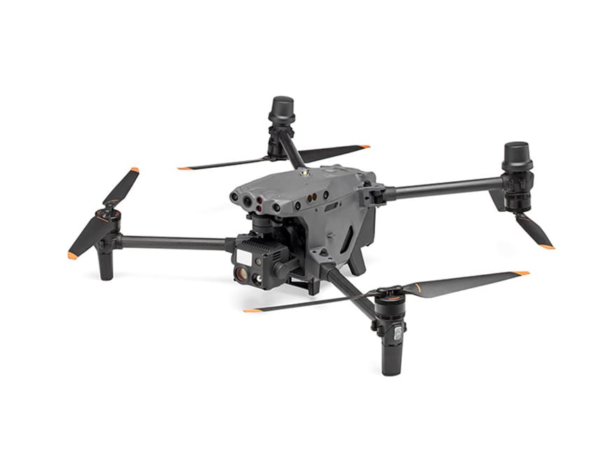
DJI M30T
The DJI M30T is a powerful, industrial-grade drone designed for professional applications in public safety, inspection, and search and rescue operations. It features a sophisticated thermal imaging system alongside a high-resolution camera, providing detailed visual and thermal data simultaneously. The M30T boasts robust weather resistance and durability, making it capable of operating in harsh environments. Its advanced flight safety features include obstacle avoidance, multiple redundancies, and extended flight times, ensuring reliable and secure operations. With seamless integration into DJI’s control software, the M30T offers precise, real-time data transmission and mission planning, making it an indispensable tool for complex and critical aerial tasks.
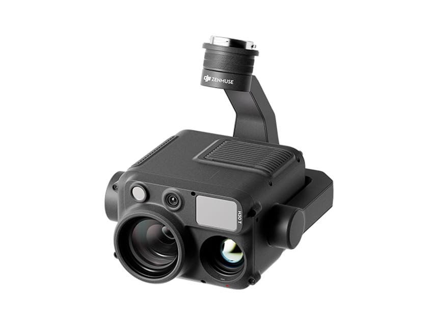
DJI H20T and H30T camera sensors
The DJI Zenmuse H20 and H30 is a high-performance camera system for professional aerial applications, combining a high-resolution zoom camera, thermal imaging sensor, and laser rangefinder. Its powerful zoom captures clear visuals from long distances, while the thermal sensor detects heat signatures in low visibility. Seamlessly integrating with DJI drones, the robust H30 is ideal for inspection, surveillance, and search and rescue missions, providing reliable and detailed data capture.
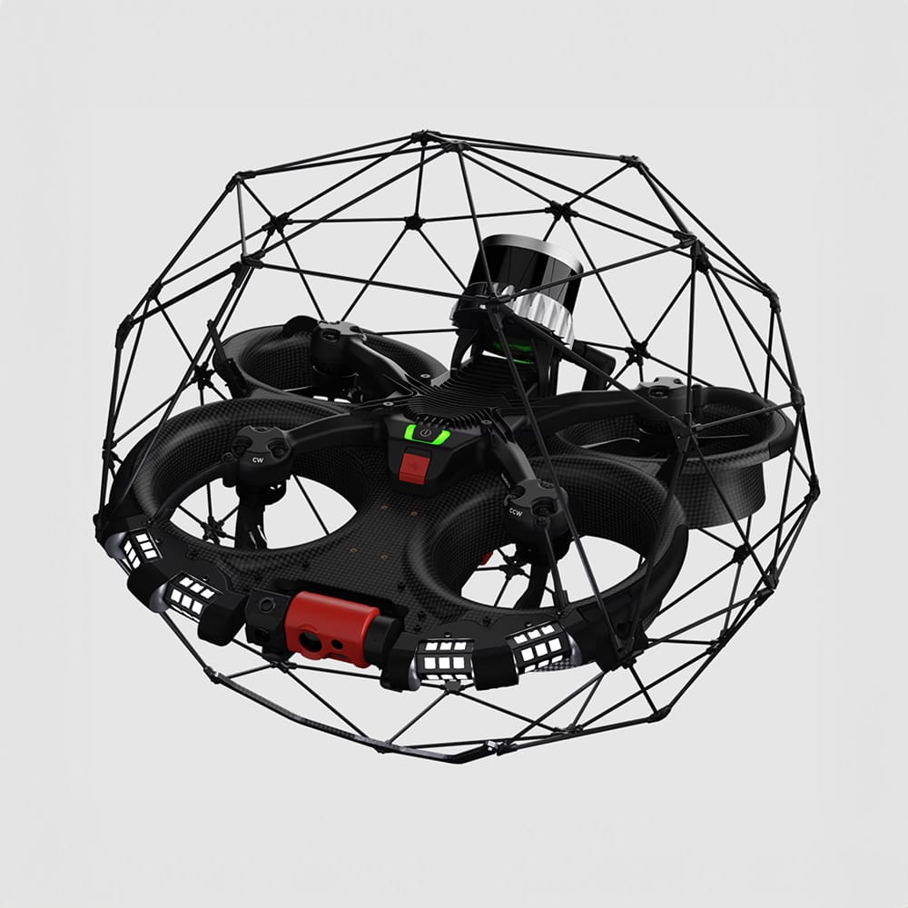
Flyability Elios 3
The Flyability Elios 3 is a versatile indoor drone designed for confined space inspections and mapping. Equipped with a 3D LiDAR sensor and high-resolution cameras, it provides detailed visual and spatial data in challenging environments. Its robust, collision-tolerant design ensures safe operation in tight and complex areas, such as industrial tanks, underground mines, and sewer systems. The Elios 3’s advanced stabilisation and navigation systems enable precise manoeuvring and data collection, while its real-time data transmission capabilities allow for immediate analysis and decision-making. Ideal for industries requiring thorough inspections in hard-to-reach places, the Elios 3 enhances safety and efficiency by reducing the need for manual entry into hazardous spaces.